Our fall, winter, and springtime weathers here on the South Sound and the West Sound pretty much come from the same place. The Chehalis gap! And no, you can’t buy jeans there.
This gap is the space between the southernmost of the Olympic Mountains and the Willapa Hills to the south. The gap is an opening that allows winds and weather systems to come ashore from the Pacific Ocean where they are born.
Whoever heard of the Willapa Hills? The highest of the hills is Boistfort Peak, 3,087 or 3,113 or 3120 feet high, depending upon which “true” internet information you use. It’s just west of the little town of Winlock in Lewis County. Some locals not only call it Baw Faw Peak, but name cheese and yogurt after it. The hills are actually the foothills of Oregon’s Coast Range.
You could ask, well why don’t those weathers, which nearly always seem to be sopping wet, blow right through the Chehalis gap and head east, staying to the south of us? Well, some do. So the Columbia River Gorge gets fairly constant high winds, but Mount Adams, Mount St. Helens and the rest of the southern Cascades get in the way.
A phenomenon called the Coriolis effect is also a force that affects the direction the weathers move.
Every fall as winter approaches, a gigantic low-pressure system, caused by the difference in temperature between the sea, the land, the ice pack and the air, forms over Alaska’s Aleutian Islands. It’s called the Aleutian Low.
It is low pressure because there just aren’t as many molecules of air in it as there are in a normal chunk of atmosphere. Many air molecules decide they don’t want to hang around in the freezing cold, so they rise up and leave the party. They hitch a ride outta there on the jet stream.
Well, Mom Nature simply can’t tolerate an imbalance of molecules, so she rushes replacements in from the south. Yup, from the central Pacific Hawaiian Island area — it’s called The Pineapple Express.
Those air molecules are nice and warm, and as they move toward the Aleutian Low, they skim the ocean and pick up tons of moisture. If the Earth didn’t spin on its axis, they’d travel toward the low-pressure system in a straight line.
But, because we are spinning at a little more than 1,000 miles per hour at the equator, the air molecules move to the low-pressure area in a huge counterclockwise arc caused by the spinning force — again, the Coriolis effect.
To complicate matters further, the Aleutian Low keeps spinning off smaller low-pressure systems that again, because the Earth turns beneath them, move relentlessly eastward until they are stalled by the Vancouver Island Mountain Ranges (yes, ranges!) and the Canadian Rockies. Then one after another, they spin over Vancouver Island, circulating moisture-laden air from Hawaii.
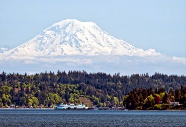
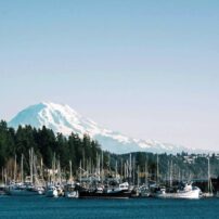
As the Earth spins and the sopping-wet air molecules try desperately to fill in each low-pressure spot, a whole bunch of them come pouring through the Chehalis gap — only to find they’re again stalled, this time by the Cascade Mountains, including the big guy, Rainier, which you can see across Carr Inlet if you live here. But not if you’re a visitor — too rainy to wait for a chance to see Rainier.
Eventually, the spinning of the Earth wins out, each low-pressure system moves east and the air molecules rise to pass over and through the mountain passes. We get rain, mist and humidity. Our atmosphere becomes a cool, damp sponge that soaks everything in its path.
And the Olympics, Canadian Rockies and Cascades get snow. While the Willapa Hills don’t get squat. They are just tall enough to help funnel southwest winds to us, but they don’t even get to be snow-capped most winters.
One last tidbit about the Coriolis effect. It’s a myth that you can see the effect by watching water circling a drain. Whether it goes clockwise or counterclockwise is purely random, mostly influenced by the shape of the sink, tub or basin that you’re draining.
Stay tuned — we’ll talk about summertime and the Coriolis clockwise spin soon.


